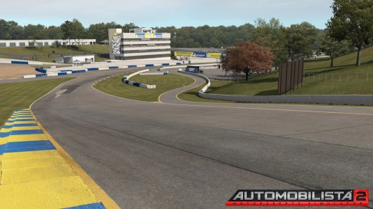
So I wasn't going to make a WIP thread for this track but I figured why not. This is my first LiDAR based track and maybe someone could learn something from the process that I used.
The track is New Jersey Motorsports Park: Lightning. This is a track that I did my first ever track days at with NASA:NE 2 years ago. It is a great little circuit and reminds me a bit of Lime Rock. There is another higher profile course called Thunderbolt also at NJMP BUT the data I have was taken in April of 2008. At that time Thunderbolt had not been paved yet. I have yet to see how final the grading was at Thunderbolt to see if the data can be used to actually build that circuit. I would like to have both maybe someday but for now my main concern is Lighting.
So here is the data in Cloud Compare.

using cloud compare I convert the data into a mesh. You then export that to stl format which then can go right into blender. This is how it looks in blender.

The data is not quite dense enough to build directly off of. For example if you tried to drive on this the bumps would be enormous. So I thought of a few different ways to go about this. I settled on a conventional spline like I did my last two tracks. I simple would lay it over on the data as close as possible by hand. Sounds like a horrible task but it went very quickly. Here is the spline and road laid onto the data. You can see it isn't perfect but you simply set the heights and cambers by hand. You try to keep the "noise" even across the whole surface.

To line up the actual layout I made an image of the point intensity data from within cloud compare. Doing this I was able to make sure the aspect ratio and scale was perfect to match the height data. Here you can see the intensity image along with the google images I lined up my hand. Google images were only used for object placement.

Here is a shot of my low poly terrain over the data.

After that it is simple track making 101. The nice thing is the guess work is removed. All the splines for guard rails, tire walls, fences, etc all simply get lined up to google images and shrink wrapped to data.
here is the complete track from within blender in its current state.

And here are some shots in sim of current build.


Most of the modeling is done at this point. Most textures are placeholders and will get much more detail in the final stages. I am hoping for maybe a release by the end of the month but there is no guarantee.
Also for those that haven't seen it here is a video @Andy-R made comparing the real thing to this AC version.
The track is New Jersey Motorsports Park: Lightning. This is a track that I did my first ever track days at with NASA:NE 2 years ago. It is a great little circuit and reminds me a bit of Lime Rock. There is another higher profile course called Thunderbolt also at NJMP BUT the data I have was taken in April of 2008. At that time Thunderbolt had not been paved yet. I have yet to see how final the grading was at Thunderbolt to see if the data can be used to actually build that circuit. I would like to have both maybe someday but for now my main concern is Lighting.
So here is the data in Cloud Compare.
using cloud compare I convert the data into a mesh. You then export that to stl format which then can go right into blender. This is how it looks in blender.
The data is not quite dense enough to build directly off of. For example if you tried to drive on this the bumps would be enormous. So I thought of a few different ways to go about this. I settled on a conventional spline like I did my last two tracks. I simple would lay it over on the data as close as possible by hand. Sounds like a horrible task but it went very quickly. Here is the spline and road laid onto the data. You can see it isn't perfect but you simply set the heights and cambers by hand. You try to keep the "noise" even across the whole surface.
To line up the actual layout I made an image of the point intensity data from within cloud compare. Doing this I was able to make sure the aspect ratio and scale was perfect to match the height data. Here you can see the intensity image along with the google images I lined up my hand. Google images were only used for object placement.
Here is a shot of my low poly terrain over the data.
After that it is simple track making 101. The nice thing is the guess work is removed. All the splines for guard rails, tire walls, fences, etc all simply get lined up to google images and shrink wrapped to data.
here is the complete track from within blender in its current state.
And here are some shots in sim of current build.
Most of the modeling is done at this point. Most textures are placeholders and will get much more detail in the final stages. I am hoping for maybe a release by the end of the month but there is no guarantee.
Also for those that haven't seen it here is a video @Andy-R made comparing the real thing to this AC version.


