I've been tinkering with a street track in my hometown but Earth has awful height data. I can tell that where i live is not 6 meters above sea level, closer to 16 or more. Resolution is also way off, the local area is geographically very flat but it does have contours. The online kml height filler puts my track to -9999m. Any ideas how i can map these myself using basic surveying technics and/or GPS since there's no way i'm buing topographic maps of the area.
Google Earth and height data
- Thread starter Kennett Ylitalo
- Start date


Latest News
-
 Racing Club Schedule: June 9 - 16 - Le Mans Special WeekThe 2024 Le Mans 24 Hours are fast approaching, and that is very much apparent in our Racing...
- Yannik Haustein
- Updated:
- 3 min read
-
"A system for more realism, precision, fidelity and ease of use": Interview With Marble LabsMarble Labs are newcomers in the sim racing space, but the Las Vegas-based company has big...
- Yannik Haustein
- Updated:
- 5 min read
-
 2024 Formula One Canadian Grand PrixMontréal is the location for round 9 of the 2024 Formula One World Championship. The Circuit...
- Connor Minniss
- Updated:
- 4 min read
-
![Luca [OT]](/data/avatars/s/3235/3235113.jpg?1697196734) Ride A Rollercoaster In Assetto CorsaSome racetracks with plenty of elevation change are described as rollercoasters, but how about...
Ride A Rollercoaster In Assetto CorsaSome racetracks with plenty of elevation change are described as rollercoasters, but how about...- Luca Munro
- Updated:
- 2 min read
-
Test Drive Unlimited Solar Crown Demo Available On SteamAfter its release date being announced recently, Test Drive Unlimited Solar Crown is now...
- Yannik Haustein
- Updated:
- 2 min read
-
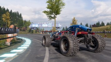
Monster Jam Showdown: "Freestyle" Trailer Shows More GameplayAnother week, another teaser trailer for Monster Jam Showdown. This time, it is all about...
- Connor Minniss
- Updated:
- 2 min read
-
Sim Racing, Friends & Fun: MOZA R3 Bundle Community Launch Event RecapFor the first time ever, the OverTake office opened its doors to the community for the MOZA R3...
- Yannik Haustein
- Updated:
- 3 min read