Great job! Just all I can say.
Tracks Nemuno Žiedas 1987-Present
- Thread starter mantasisg
- Start date
") I'll use your video in mod overview, if you don't mind, nice speed to catch a vibe of track.
I'll use your video in mod overview, if you don't mind, nice speed to catch a vibe of track.


Latest News
-
 2024 Formula One Canadian Grand PrixMontréal is the location for round 9 of the 2024 Formula One World Championship. The Circuit...
- Connor Minniss
- Updated:
- 4 min read
-
 Test Drive Unlimited Solar Crown Demo Available On SteamAfter its release date being announced recently, Test Drive Unlimited Solar Crown is now...
- Yannik Haustein
- Updated:
- 2 min read
-
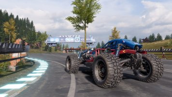
Monster Jam Showdown: "Freestyle" Trailer Shows More GameplayAnother week, another teaser trailer for Monster Jam Showdown. This time, it is all about...
- Connor Minniss
- Updated:
- 2 min read
-
Sim Racing, Friends & Fun: MOZA R3 Bundle Community Launch Event RecapFor the first time ever, the OverTake office opened its doors to the community for the MOZA R3...
- Yannik Haustein
- Updated:
- 3 min read
-
F1 24 Handling Update To Drop June 7The state of the F1 24 handling at launch was a problem for many players. EA Sports and...
- Yannik Haustein
- Updated:
- 2 min read
-
IndyCar Secures Game Assets Following Settlement With Motorsport Games (Updated)After intending to terminate the license in late 2023, IndyCar has reached a settlement with...
- Yannik Haustein
- Updated:
- 3 min read
-
Formula Ford Festival Lights Up Automobilista 2The Formula Ford Festival, once a pillar of the UK Motorsport calendar, debuts in Automobillista...
- Connor Minniss
- Updated:
- 4 min read