Tracks Okayama [W.I.P] scratch made

Any update you can share with us? :D
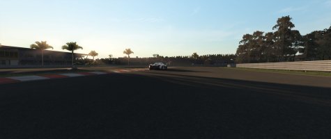
Now a lot of work is in small things (doing this for a week now), and connecting all between each other, so no holes exist. And fixing things that I didn't do correctly at the same time. Maybe some new pictures are coming tonight, when all inner part of the track will be covered (all filled with objects and textures). And yes, some work goes to create images (dds files) for all kinds of materials. Trying to stick to AC's style, to have similar materials on same image.
 
Inner part of the circuit on north side is done - no more holes in the mesh :)
I have to do the same in south side - which is easier, because the north side has so various terrain (lots of up and downs, ins and outs, crazy to model). So grass with some holes for water and access roads are done. Do not look a green material, which represents grass - missing uvw mapping, and other texture (this is only for visualization).

Here are some pics:
ok10_6.jpg


ok10_7.jpg


ok10_8.jpg


ok10_9.jpg


Do you like it?
 
Looking good :thumbsup:
It won't hurt to add a few rows of polies perhaps, so the slopes aren't as straight as they are now. Making it slightly "wavy" or bumpy would look better, I guess.
 
Been busy in the past 2 weeks. Lot of work has been done, mainly I wanted to finish the whole mesh inside of the walls - which I succeeded. I work now on building and all off side track objects.
Here is a video from the latest version.

--
And some pictures, which will tell more then the 1000 words:

ok11_1.jpg


ok11_2.jpg


ok11_3.jpg


ok11_4.jpg
ok11_5.jpg


Like the progress? I know do :)
...more then 1000 hours of work here.
 
Everytime I see a new post here I hope to see the download button appear too. :D
Very good job so far, it will be a great addition to AC.
 
No, have elevation data of the track only, but to "connect" all those data, a good eye is needed :)
What concerns all what is surrounding the track (road object) is self, its all made by eye.
 
Last edited:
Some update: track it self is almost ready (is drivable for testing). I will still have to do the 2017 changes (new tarmac, curbs, and some stuff concerning track it self).
Now I have to do the next step, which is whole environment with all the surrounding hills. That is quite a huge task, since Okayama track is located in some kind of a valley surrounded by hills all around. Working on how to pull it off.
Btw, does anyone have any idea how to make the terrain? I tried to do the terrain with SketchUp software, but it is not detailed enough (if it is, its huge, with so many polys). Then I think of using Topographical map, and defining all the elevation lines (in 3ds max this is then easy to do the terrain with using Terraib modifier). But still quite some work, since this environment is very demanding.

BTW: tomorrow in the 1st race of Super GT in Okayama, you can watch the even live on youtube.com
 
Last edited:
There are several mesh optimizers available to use. Going from 3+ million to maybe 500k should be easy :)
Maybe weight it so it reduces more the further away from the track.
 
did you test if sketchup terrain affect track perfomance?¿
The thing is, that Sketchup terrain is far from being detailed. I tried to make the whole environment, but I was not happy with the outcome really. I will rather use some other technique, like using a terrain map (still looking for the best and optimized possible, like LIDAR). Btw, does anyone know where to get best possible terrain maps with specified heights (google maps leaks of it) for Japanese location HERE.
What I have in mind is to draw splines on every line of elevation, and then with a use of Terrain modifier in 3ds max create a terrain. I know its time consuming, but its the most accurate as it gets. As said, google maps are still not good enough to use it for this manner.
 
Last edited:
Awesome seeing this project develop this well. Okayama is one of my favorite racing circuits, so I'm really looking forward to a quality version of it in AC. I'll wait patiently :). Keep it up.
 
The thing is, that Sketchup terrain is far from being detailed. I tried to make the whole environment, but I was not happy with the outcome really. I will rather use some other technique, like using a terrain map (still looking for the best and optimized possible, like LIDAR). Btw, does anyone know where to get best possible terrain maps with specified heights (google maps leaks of it) for Japanese location HERE..

Do you still need this? I've managed to locate SRTM1 data for the area and import it into Blender.
 

Latest News

What would make you race in our Club events

  • Special events

    Votes: 88 30.3%
  • More leagues

    Votes: 58 20.0%
  • Prizes

    Votes: 63 21.7%
  • Trophies

    Votes: 37 12.8%
  • Forum trophies

    Votes: 18 6.2%
  • Livestreams

    Votes: 48 16.6%
  • Easier access

    Votes: 146 50.3%
  • Other? post your reason

    Votes: 42 14.5%
Back
Top